Access to Healthy Food in New York City
2019 | with Yuning Feng and Elaine Hsieh | Tools: ArcGIS, Illustrator, InDesign
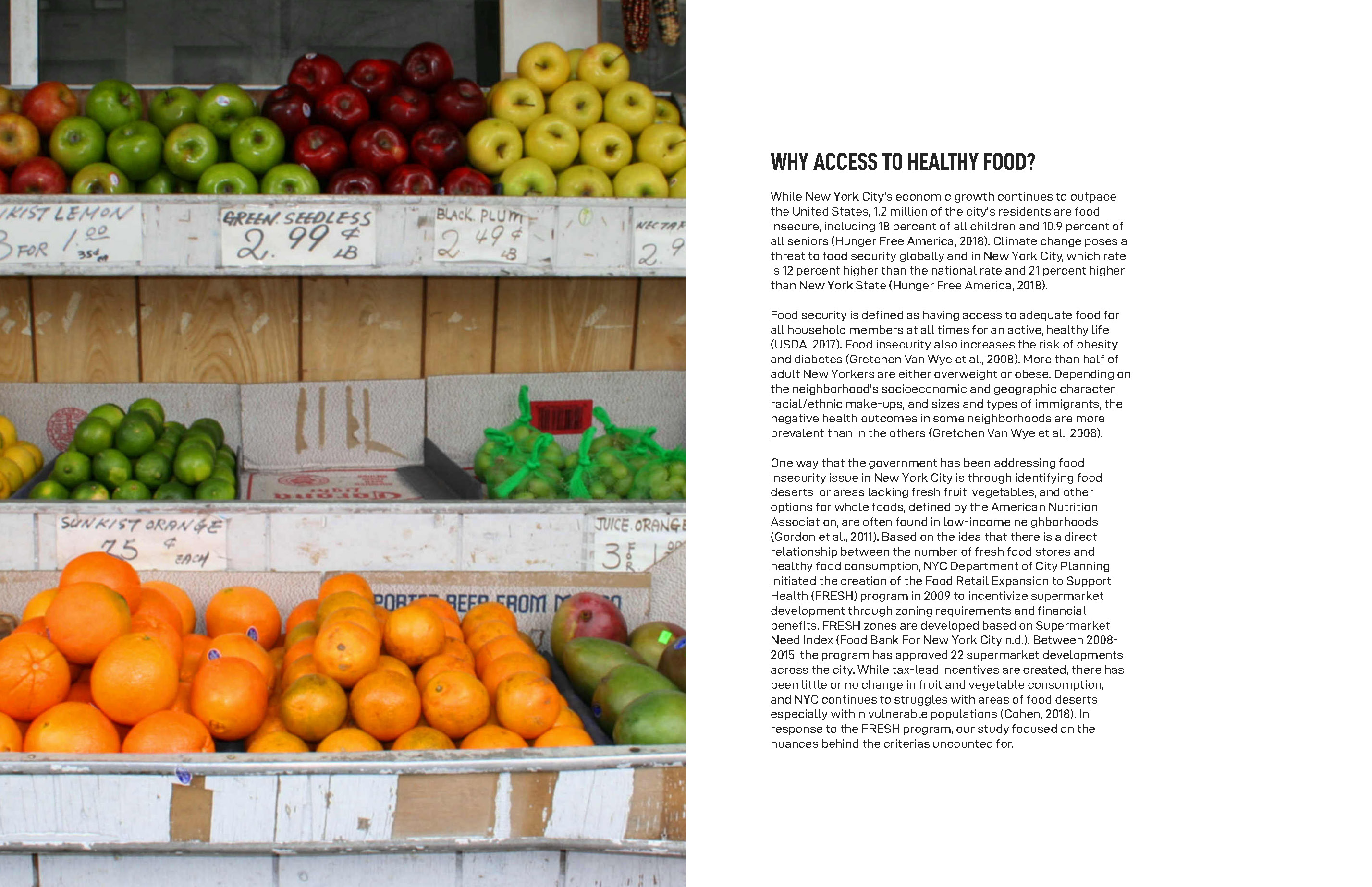
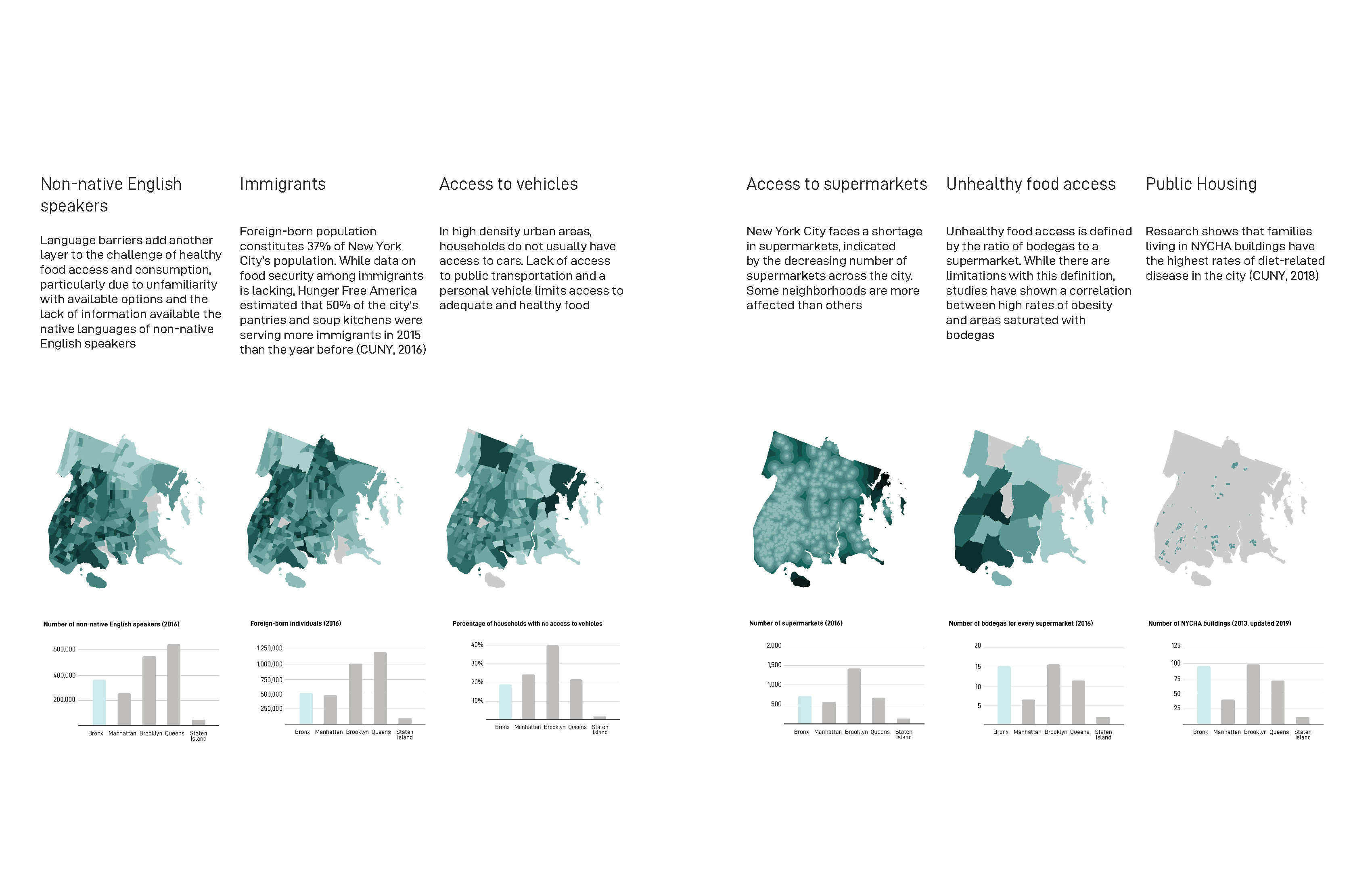
While New York City’s economic growth continues to outpace the United States, 1.2 million of the city’s residents are food insecure, including 18% of all children and 10.9% of all seniors. Food security is defined as having access to adequate food for all household members at all times for an active, healthy life. Food insecurity also increases the risk of obesity and diabetes, and more than half of adult New Yorkers are either overweight or obese. However, negative health outcomes related to food insecurity are more prevalent in some neighborhoods than in the others.
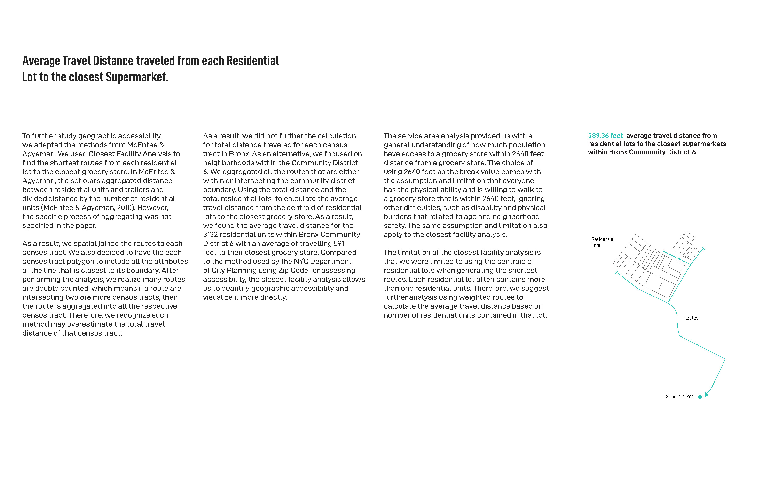
One way that the government has been addressing food insecurity issue in New York City is through identifying ‘food deserts’ or areas lacking fresh fruit, vegetables, and other options for whole foods, as defined by the American Nutrition Association. These areas are often found in low-income neighborhoods. Given a direct relationship between the number of fresh food stores and healthy food consumption, New York City Department of City Planning initiated the creation of the Food Retail Expnasion to Support Health (FRESH) program in 2009 to incentivize supermarket development through zoning requirements and financial benefits.
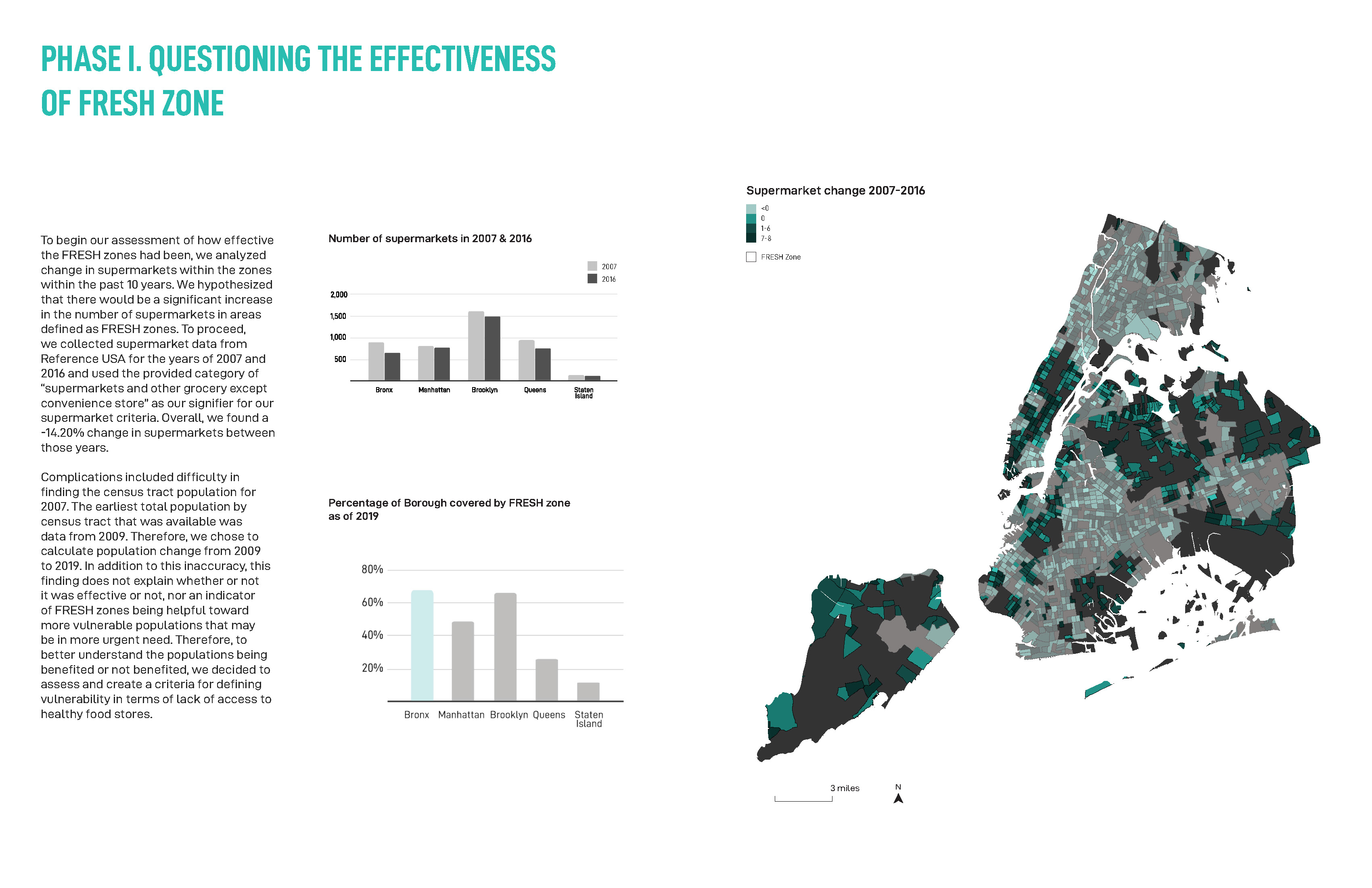
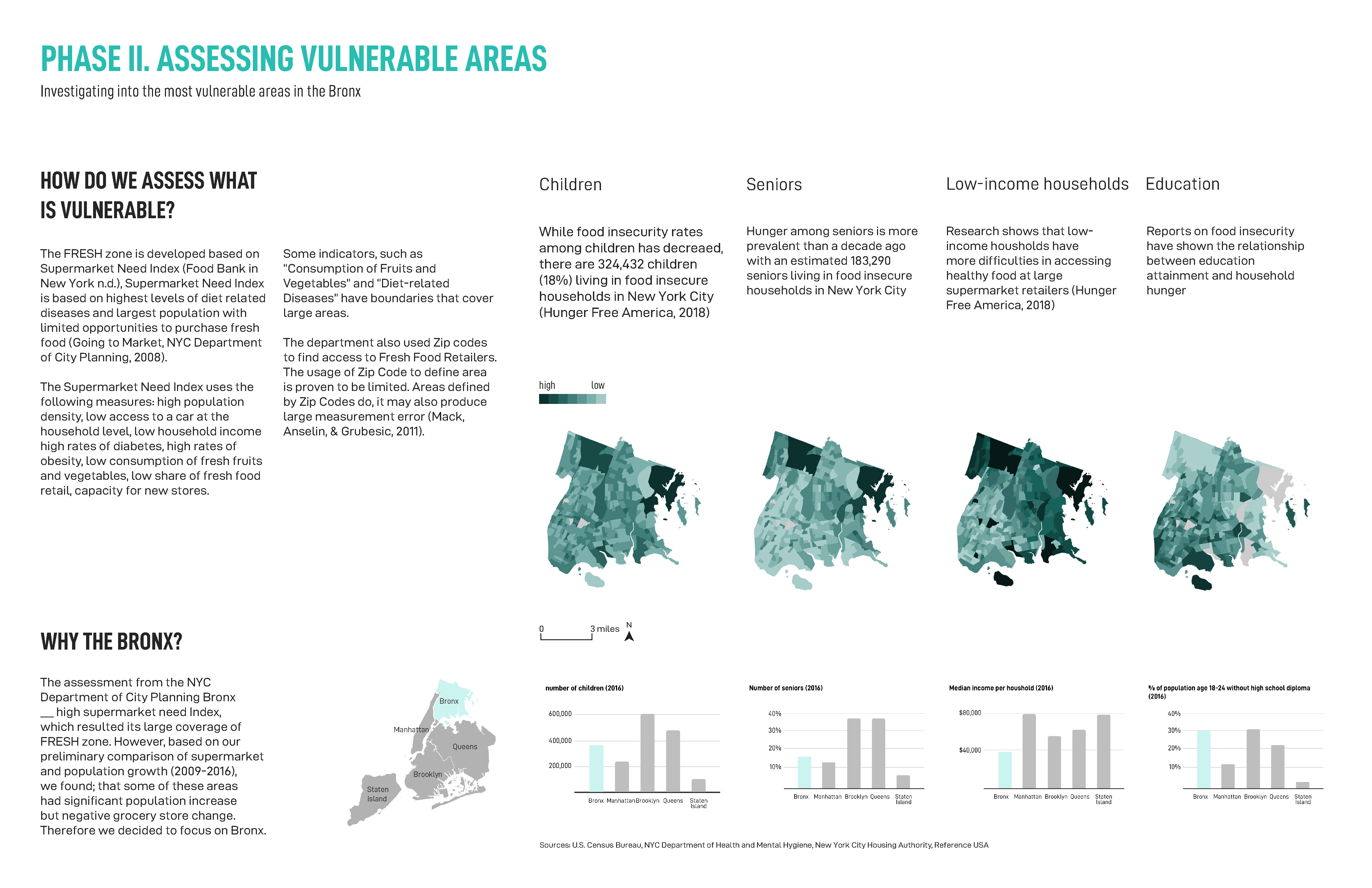
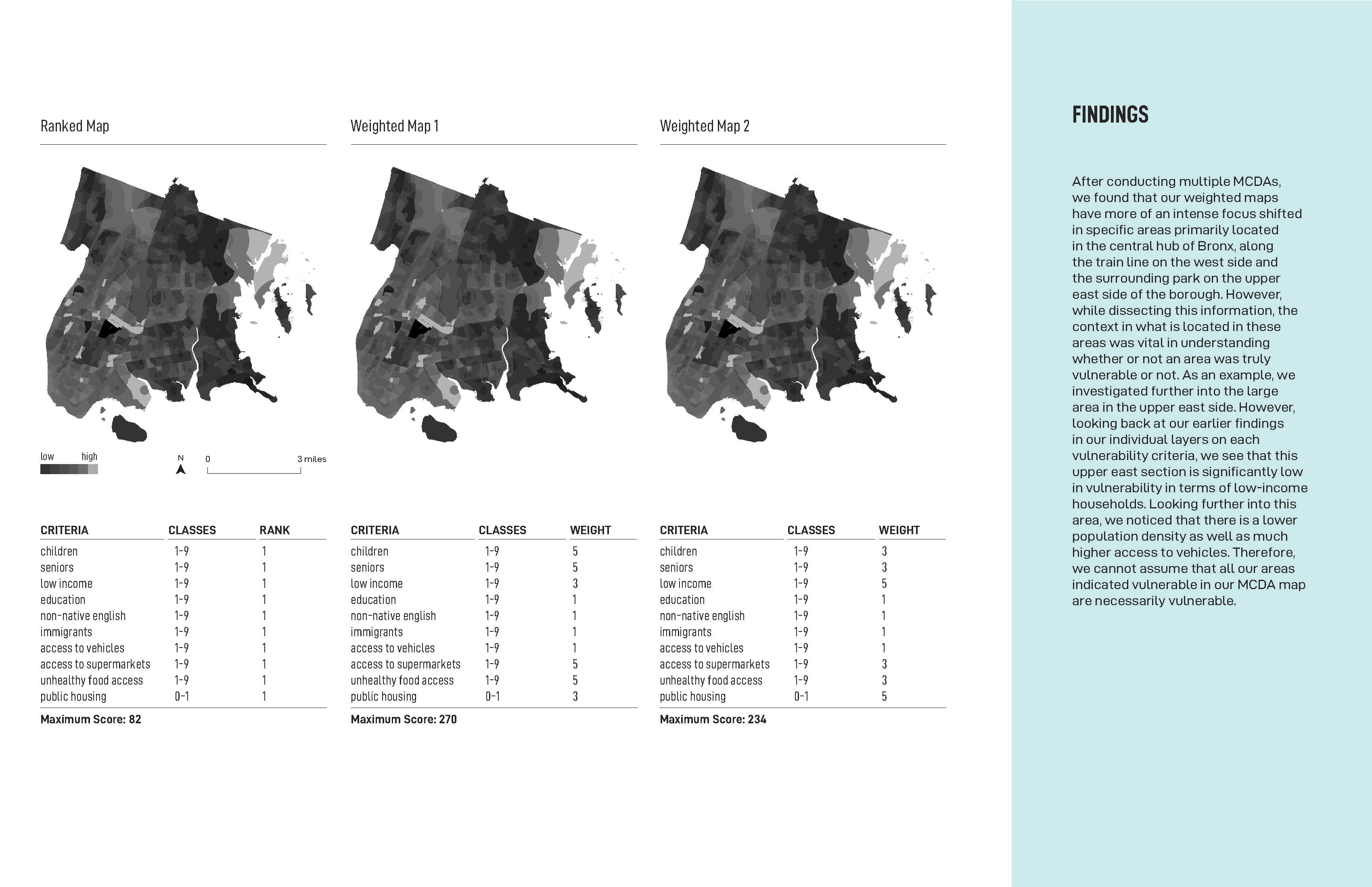
Our study focuses on understanding spatial relationships between the FRESH zone districts and areas in need of healthy food options. Our investigation includes questioning the effectiveness of FRESH zone districts, identifying communities that are vulnerable to food insecurity, and assessing geographic access to supermarkets in vulnerable areas.